
Introduction to Map - Longitude/Latitude
If your data contains longitude and latitude information, then you can quickly visualize the data geographically with one of the Map types called ‘Map — Long / Lat’ in Exploratory.
Sample Data
We'll use this US Hospital Rating data. You can download it from this page.
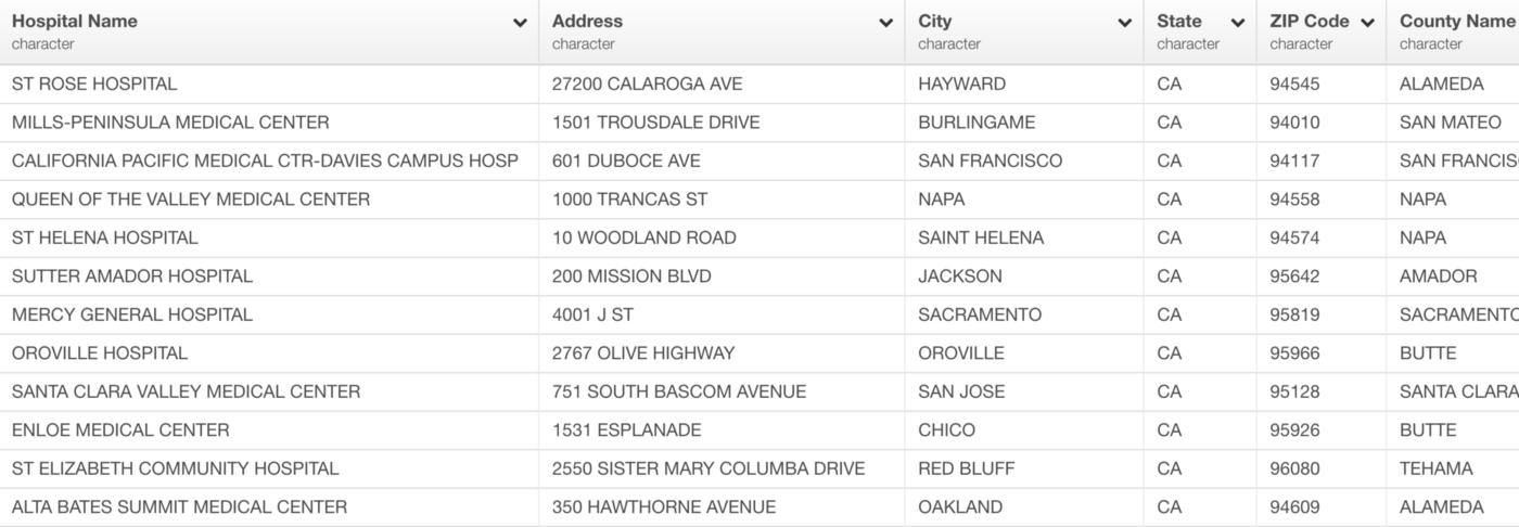
In this data, each row represents each hospital and it has the rating score (1 to 5, 5 is the best) based on the patient survey along with the hospital information including the location related information.
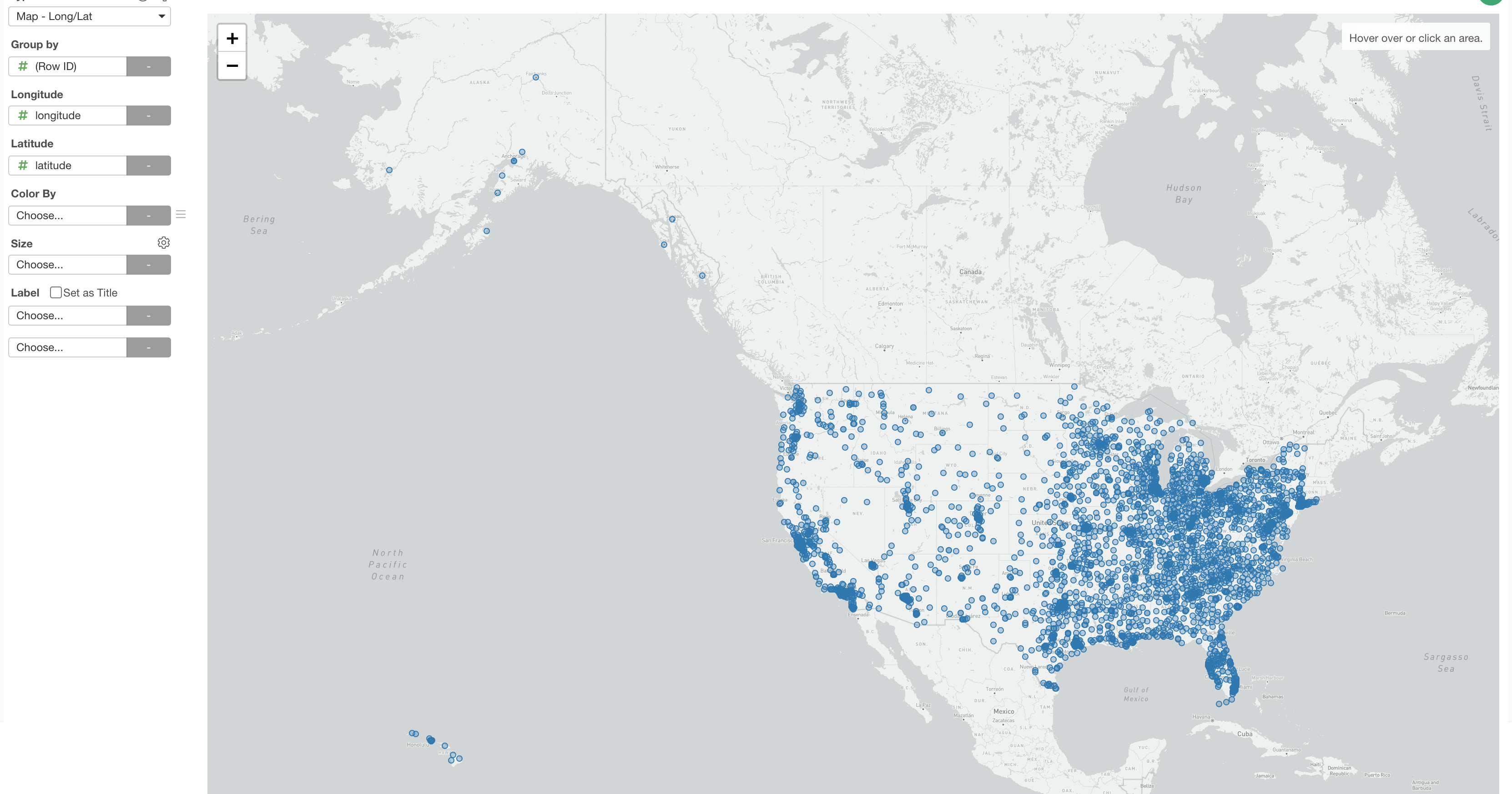
1. Create a Map with Longitude / Latitude
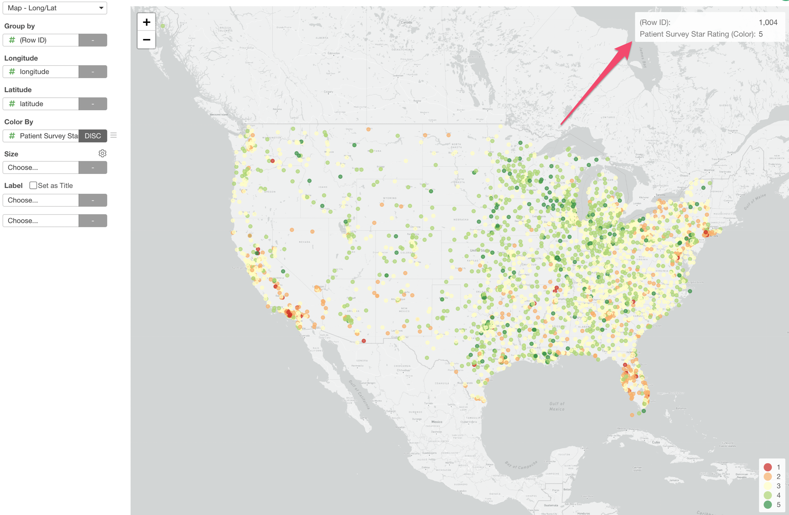
Let’s say we want to visualize where all the hospitals are on Map.
Select 'Map - Long / Lat' and assign the longitude and the latitude columns.
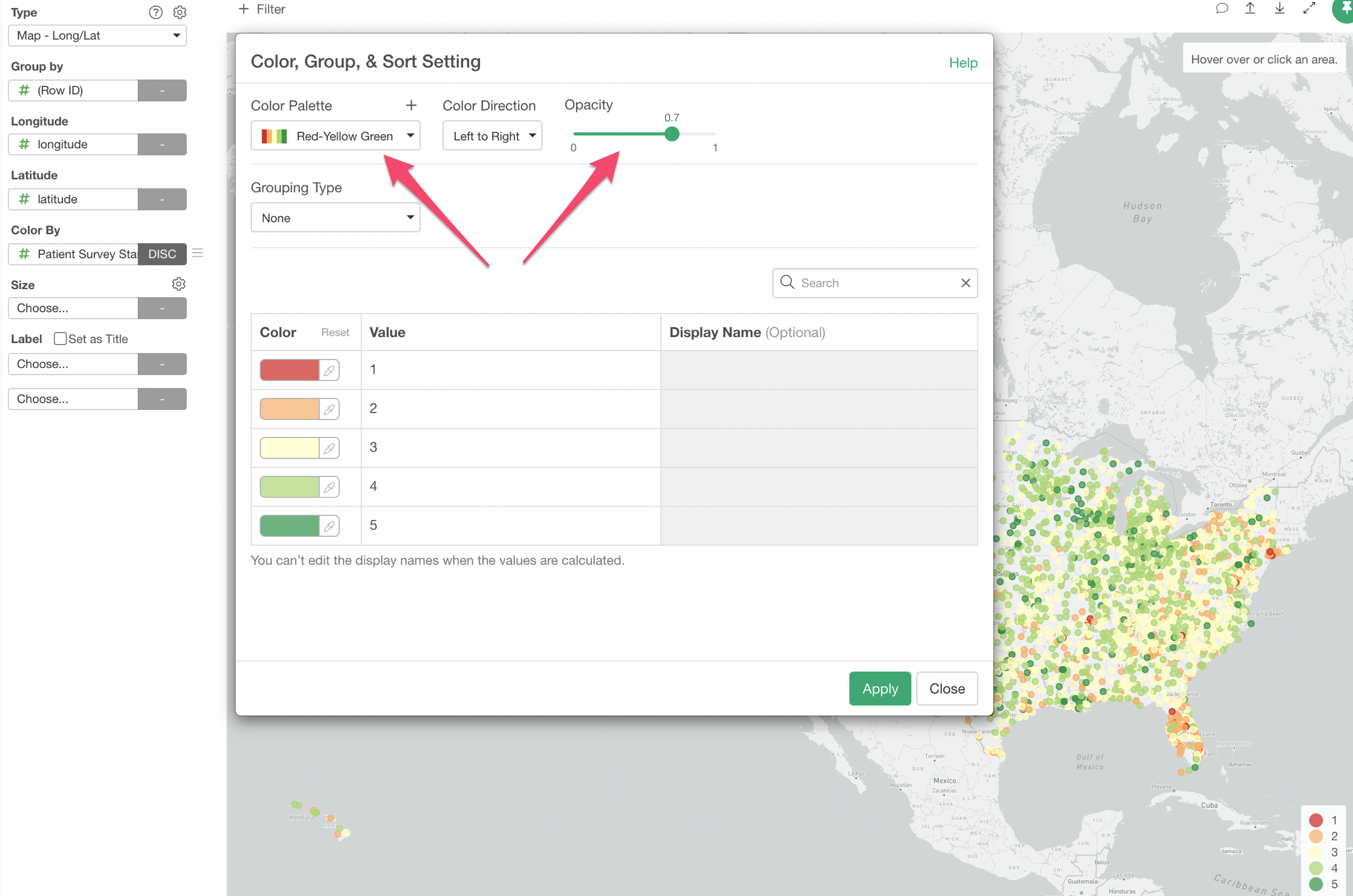
2. Use Color and Configure
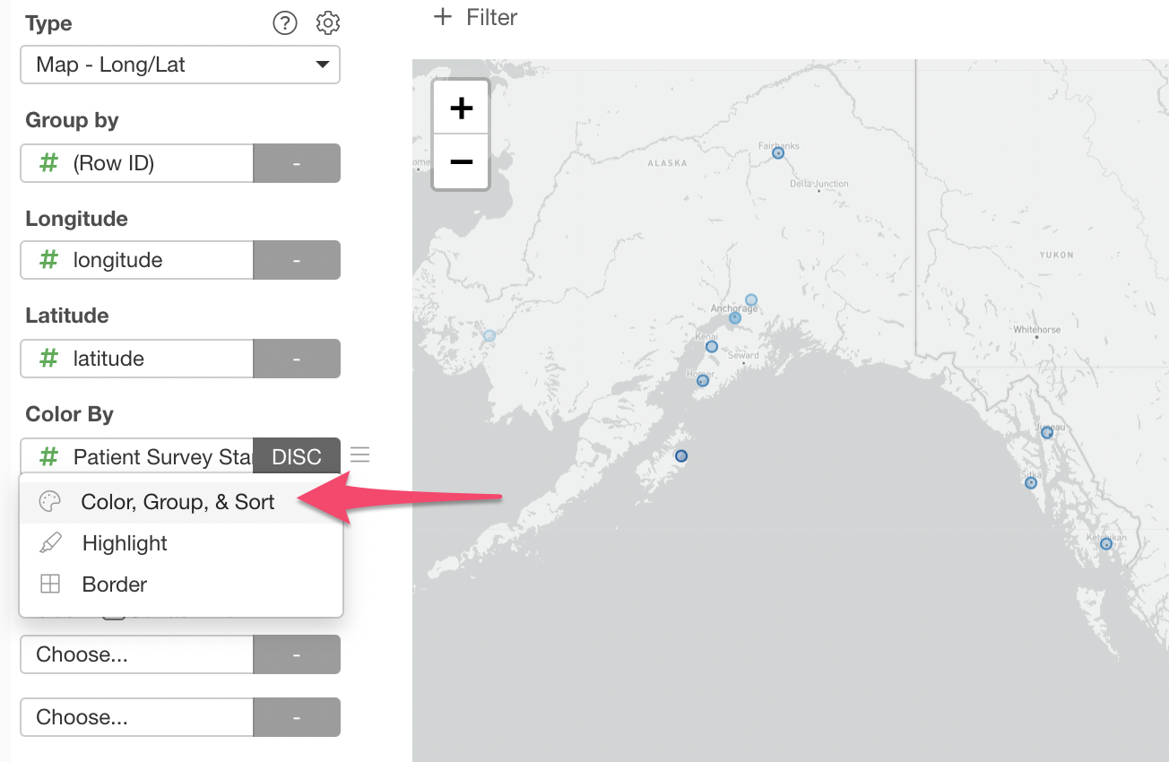
We can use Color to visualize the hospital rating score by assigning 'Hospital Survey Star Rating' column to the Color.
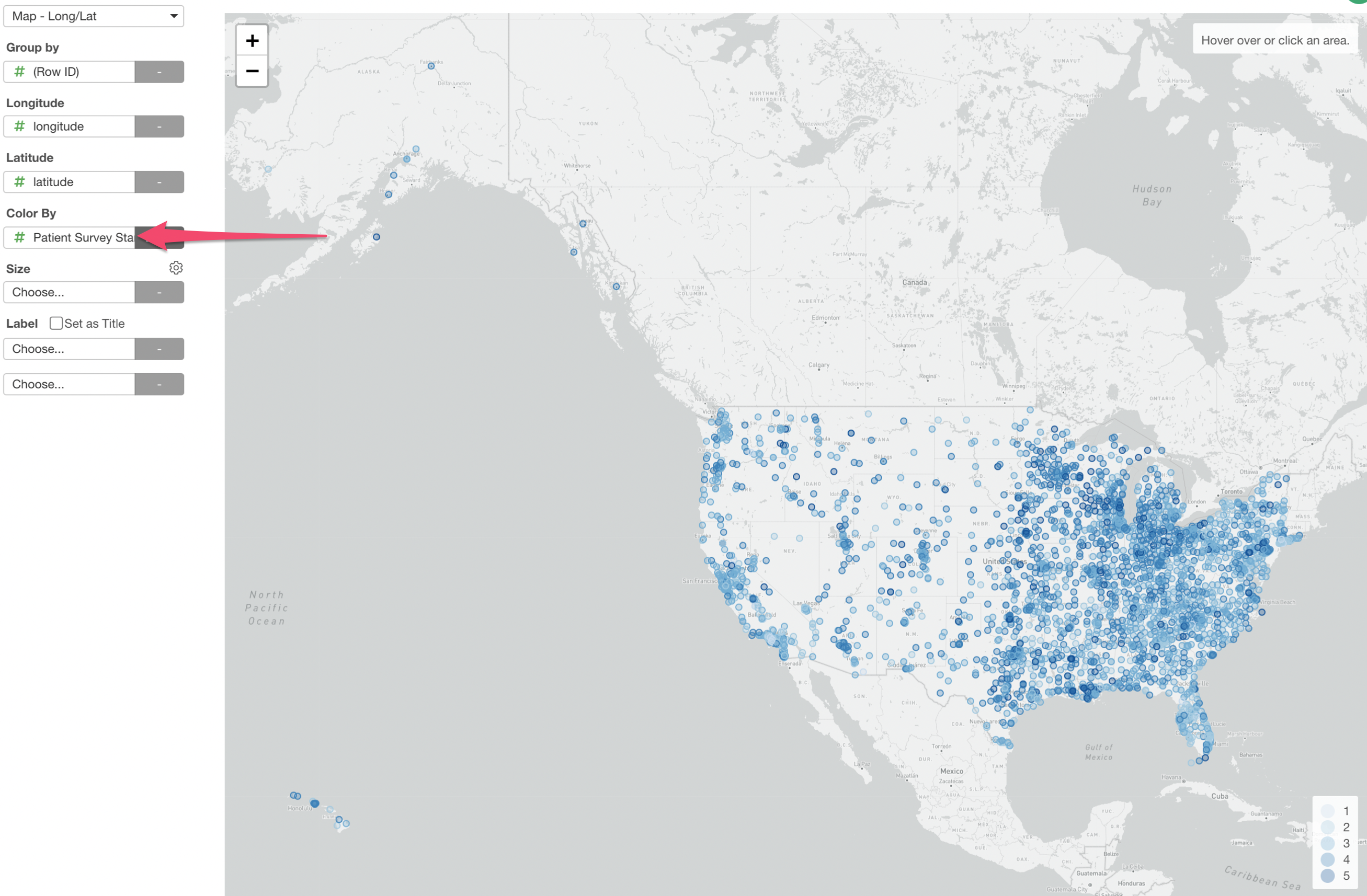
You can change the color palette from the Color & Group configuration dialog.
Here, I have changed the Color Palette to 'Red-Yellow-Green' and also the Opacity to 0.7.
3. Use Label to Show the Label Text
Currently, when you move the mouse over on one of the dot you can see the rating score in the pop-up box at the right hand side top.
We can show which hospital each dot represents by using the Label.
Select the 'Hospital Name' column to the Label
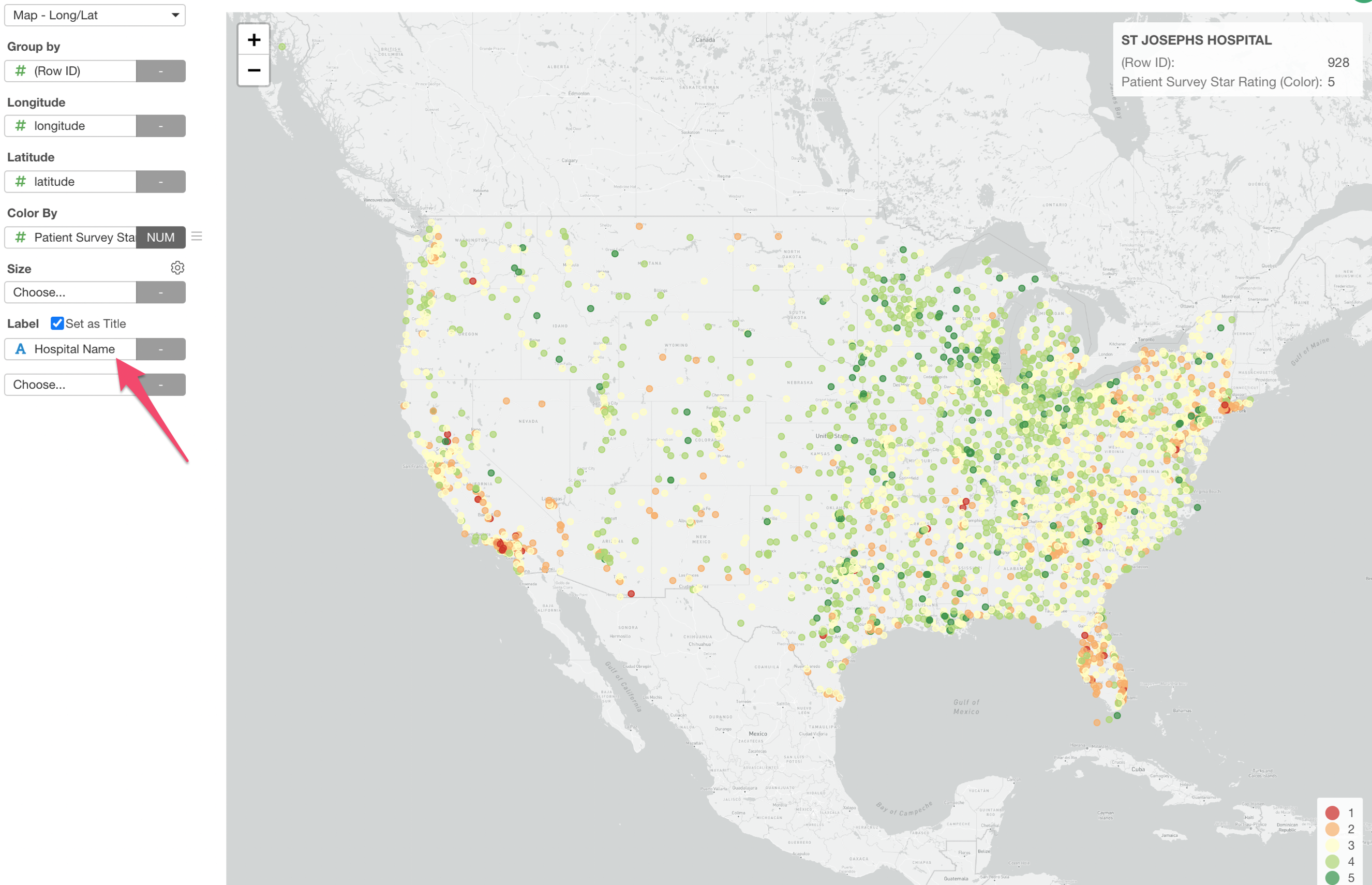
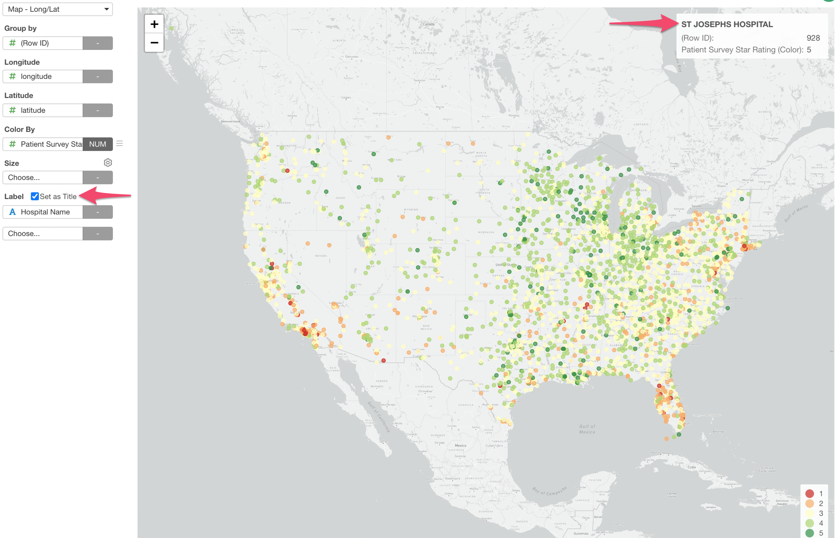
Also, click on the 'Set as Title' so that the hospital name will be shown as the Title in the pop-up box.
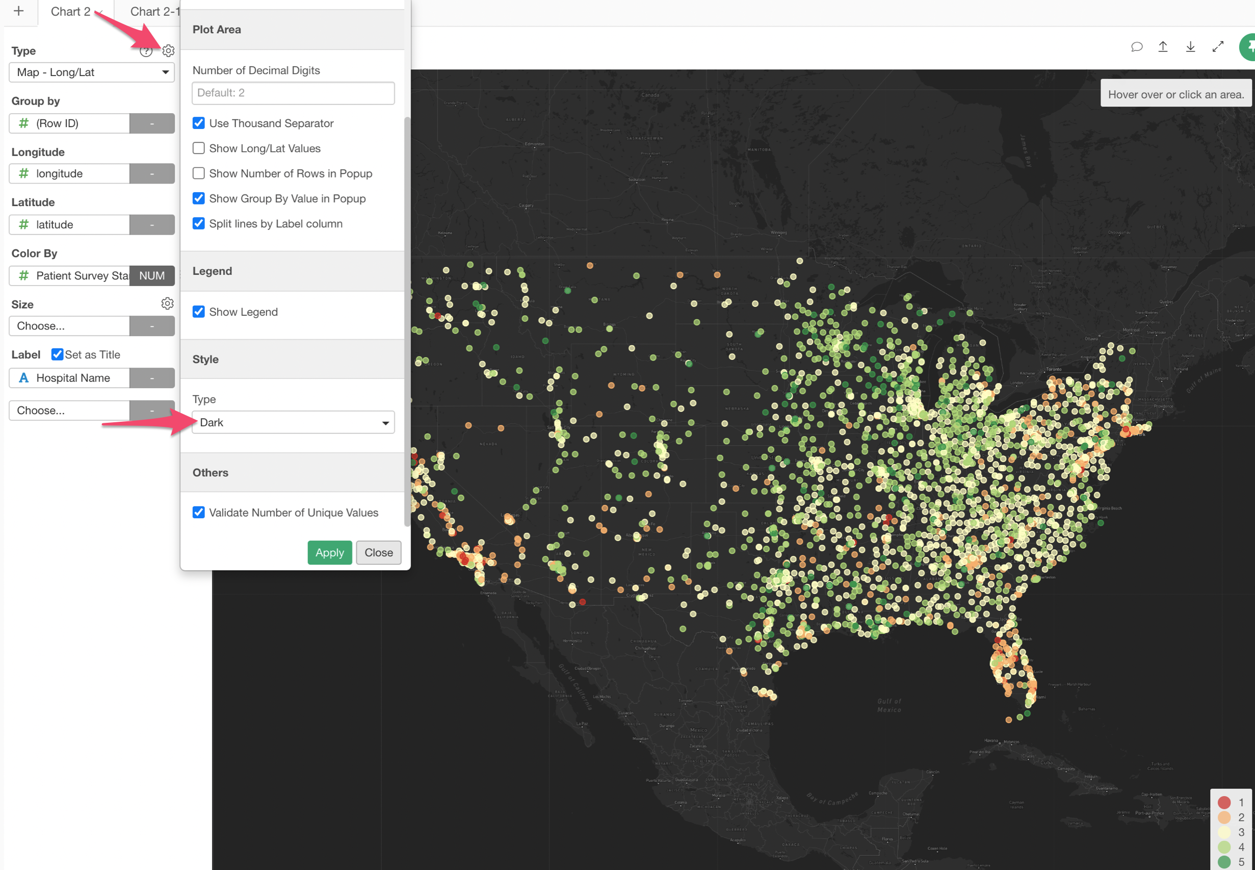
4. Change Map Style
You can change the map style if you like. The default is 'Light Gray', but for example, we can change it to 'Dark'.
Try it for yourself!
If you want to quickly try it out and you don’t have an Exploratory account yet, sign up from our website for 30 days free trial without a credit card!
If you happen to be a current student or teacher at schools, it’s free! Sign up for Community Plan.
And, if you don’t mind sharing what you create publicly you can sign up for Public edition of Exploratory (FREE)!